26 December 2013

Milestone XV


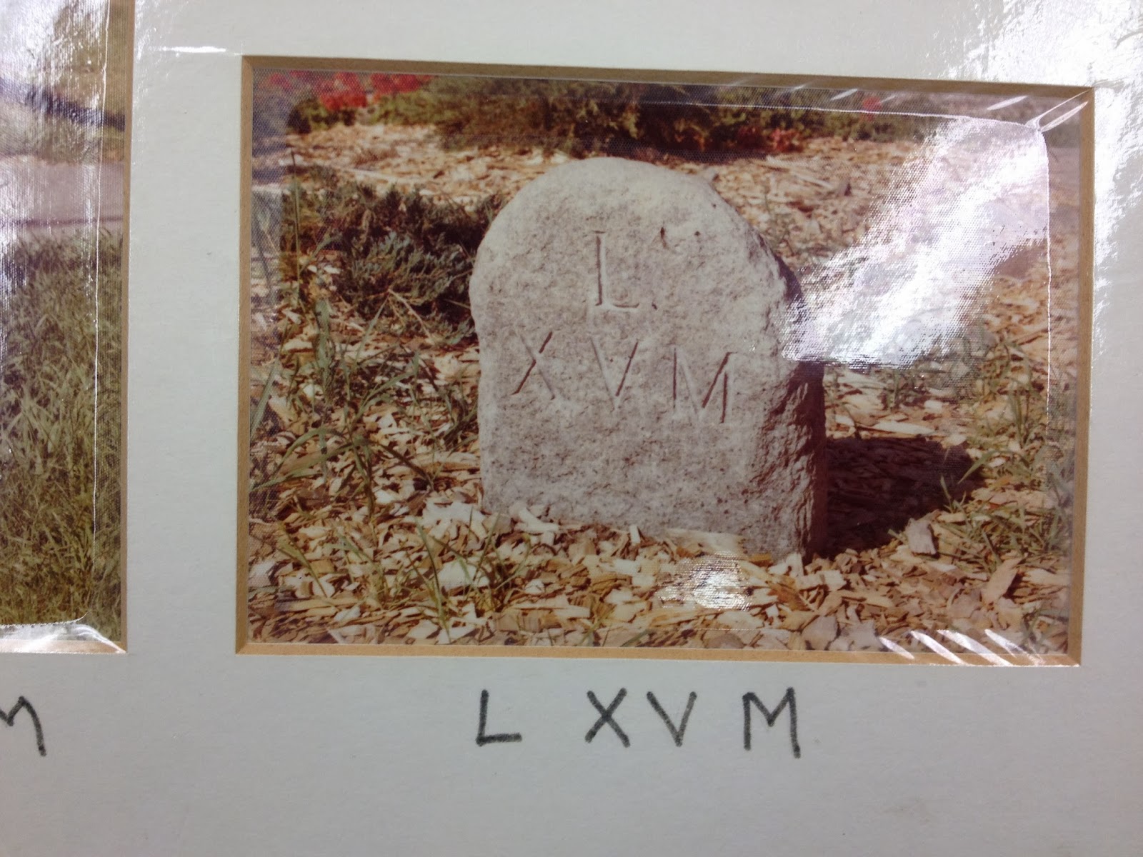
Located at the original site of the meeting hall built by the first European settlers in the 1600's, this milestone is near what is now known as the South Green and Soldiers Monument. The Meeting House for the Congregationalists was the first building, more closely resembling a fort than the popular image of a white colonial New England church. It was used for governmental operations (Congregationalism being the established church at the time) and as a defensible stronghold (although no battles were recorded there). When a new church building was being planned around the turn of the nineteenth century, a dispute arose about its location. Those favoring a more northerly location eventually split from the original church and formed the “Strict Congregational Church”, today known as the North Congregational Church. That church sits at the corner of Rtes. 6 (Main Street North) and 47 (Washington Road), at the location of Milestone XIV. Eventually, the "new" First Congregational Church was built halfway between the two milestones.


Sage (1922)

Bicentennial Report (1976)

Hampton (2013)
A comparison of the Sage (1922) photo of Milestone XV with the Bicentennial photo and the current day appearance of the milestone strongly suggests that the stone we see today has been recut (possibly by machine) with the appropriate markings to correct what Sage (1932) described as “so weather beaten that none of the original inscriptions appears.” The over shape of the stone in each picture seems to match, so this seems to be the original stone. Sage describes the white lettering shown in his photograph as “paint recently applied . . . which may account for the “M” being below the XV, instead of on a line with the number, as is the case in the originals.”
To the West of this milestone is the Hurd House and to the East, District No. 2 Schoolhouse, two historic buildings maintained by the Old Woodbury Historical Society.

Lat: N 41° 32.254'
Long: W 073° 12.426'

Milestone XIV


This stone was my introduction to the Benjamin Franklin Milestones in the 1970’s, when I became a member of North Congregational Church, the backdrop for this milestone. The stone had already been “decapitated”, as shown in the Bicentennial photograph and, in fact, in the 1922 Sage photograph.  It now has an apparent fracture line at the current soil height (about a foot higher than shown in the 1922 photo). The “Benjamin Franklin Milestone” plaque is visible in both of the more recent photographs.
Sage (1922)

Bicentennial Report (1976)

Hampton (2013)


North Congregational Church arose from a schism at the turn of the nineteenth century with the First Congregational Church, which was originally located in the vicinity of Milestone XV. Allegedly, members from the northern parts of town wanted the new church built closer to them. A review of church records in the acquisition of the new location might make some reference to the milestones.

This is furthest north along the "Middle Road Turnpike" portion of the Woodbury-Litchfield series of milestones. Roughly following modern-day Route 6, the building and private ownership of Middle Road Turnpike from Danbury to Farmington was authorized by a private law in 1803, divided in Woodbury into "East Middle Road Turnpike" and "West Middle Road Turnpike" by the legislature in 1823.  (Resolves and Private Laws of the State of Connecticut: From the Year 1789 to 1836. Vol I - II. Hartford: John B. Eldredge, 1837.)

Lat: N 41° 33.085'
Long: W 073° 12.289'

Milestone XI (not found)


Sage (1922) - estimated location

According to Sage, “there never was any such stone,” with a boulder found at the desired location substituted for the quarried milestones and inscribed with the appropriate markings. He reports (without attribution) that sometime prior to the Civil War, the boulder was split up and used as foundation for a barn. His map places this milestone in on Flanders Road between modern-day Brushy Hill Road and Coach Light Road.

The Bicentennial report identifies a stone “just south of the mail box on the Jason Parker property” as #12, noting that it had been patched, with only part of the Roman numerals showing, and a marker in place. Given the confusion in that report concerning #10 and #11, it is uncertain if Isham is referring to the “boulder” described by Sage.

Hampton (2013) - estimated location
Our 2013 search includes a photograph of a natural stone/boulder with an arched top akin to the milestone style. No inscription is visible. It is included for illustrative purposes, with no evidence that it was used as a milestone. Further research in the town’s land records and the records of the Old Woodbury Historical Society may provide greater details on the location and condition of this milestone.


Lat: N 41° 35.459'
Long: W 073° 12.347'